A modular geospatial knowledge graph and toolkit designed for modern geospatial applications.
Endpoint Ontology Whitepaper - ManualToposKG offers a unique combination of features that make it an ideal choice for your geospatial knowledge management needs.
Comprehensive worldwide geospatial data representation with consistent modeling.
ToposKG sources high quality geospatial data from GAUL, GMBA Mountain Inventory, Marine Regions and OpenStreetMap.
High quality data sources ensure topological consistency on the upper adminstrative levels.
Easily extendable design that adapts to your specific geospatial data needs and use cases.
Our comprehensive tool-suite facilitates a modern approach to working with knowledge graphs. From visual interfaces to command-line utilities, we support the construction, manipulation and extension of the graph to your needs.
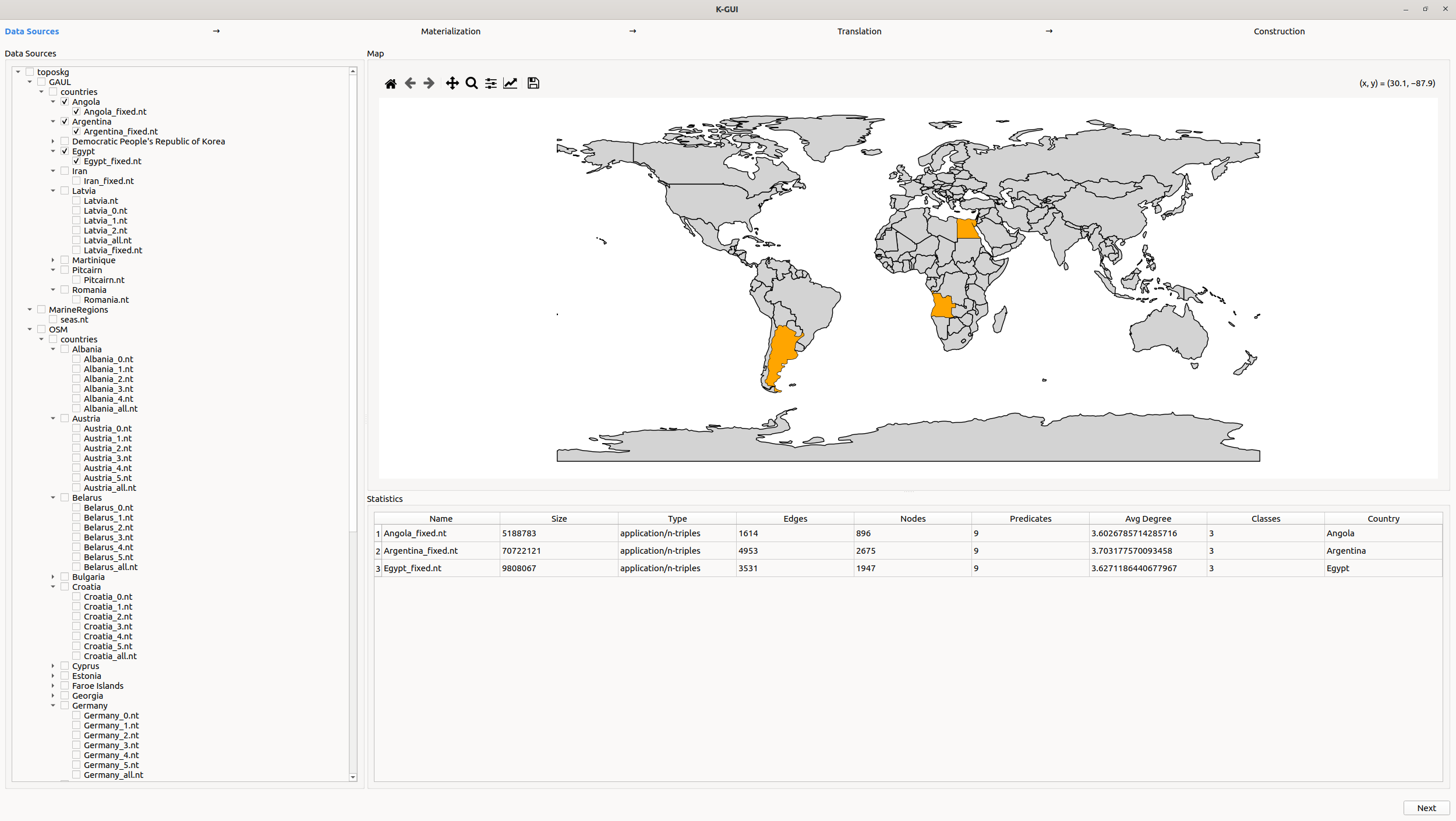
An intuitive GUI for exploring and querying the knowledge graph with ease. Built using Python, Qt and our official Python library.
View on GitHub
The core ToposKG library available on PyPI for integrating, querying, and expanding the graph programmatically.
View on PyPI View on Google Colab
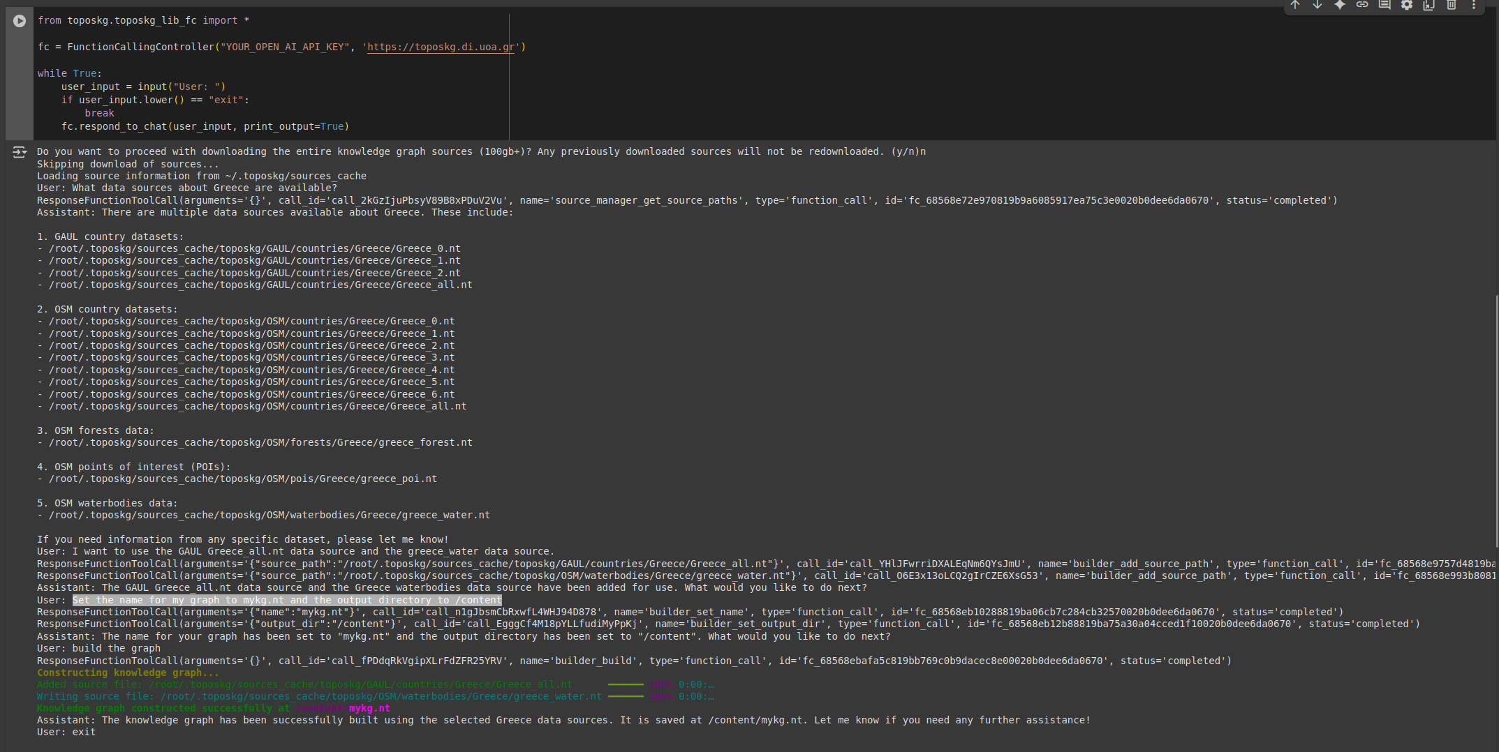
A terminal-based assistant for natural language querying of the knowledge graph—lightweight and scriptable.
View on Google ColabBrowse and download available geospatial data sources
Download the complete ToposKG dataset from our official Zenodo repository.
Download from ZenodoUse the official Python package toposkg to fetch datasets programmatically.
Manually browse and download specific data sources using the interface below.
Browse InterfaceIf you want to manually download specific data sources you can do so through this interface:
Loading data sources...
Select a data source to view details
Publication under review.
PhD Candidate
PhD Candidate
Scientific Supervisor, Professor
"GD.402. ARCHI-YPPhD-0824" PhD scholarship
"NIK. D. XRYSOVERGI" PhD scholarship
© 2026 AI Team. All Rights Reserved.