Tools
Explore the tools built around the ToposKG knowledge graph.
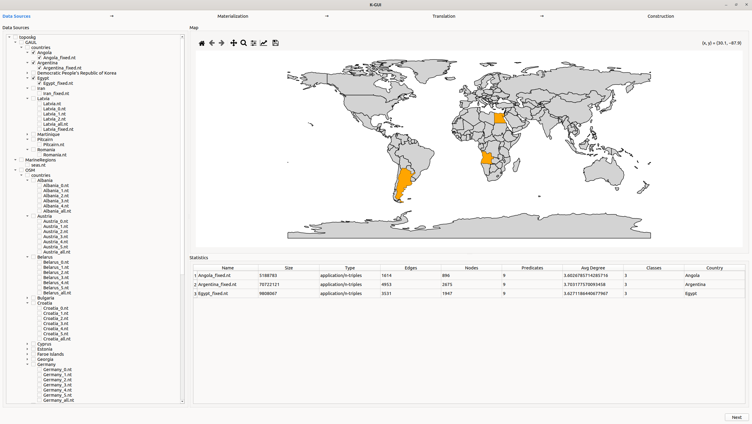
Visual Interface
An intuitive GUI for exploring and querying the knowledge graph with ease. Built using Python, Qt and our official Python library.
View on GitHubPython Library
The core ToposKG library available on PyPI for integrating, querying, and expanding the graph programmatically.
View on PyPI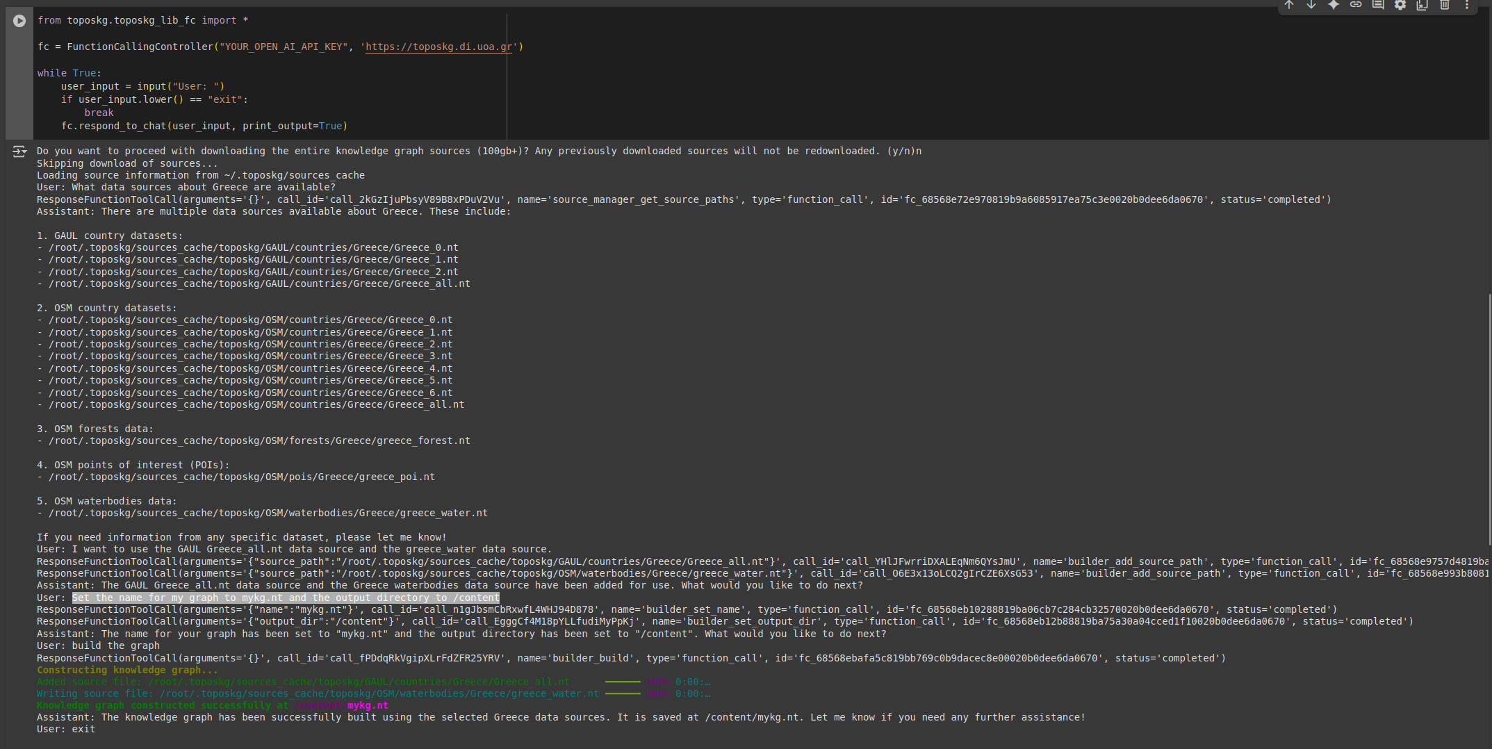
Terminal Chatbot
A terminal-based assistant for natural language querying of the knowledge graph—lightweight and scriptable.
View on Google Colab